We left Freeport in the northern Bahamas on May 18th when there was a short break in the northerly wind. The prevailing winds are supposed to push us northwards towards our final destination on the US East Coast, but this year has not been normal. It has something to do with climate change and El Niño. We left under full sail in the afternoon, not sure how many days we would make before having to put into port.

Our crew was stronger by one member…our friend Chuck. He was on the original voyage to cross the Atlantic a year earlier and was up for helping us do another leg. His infectious sense of humour and positive energy made the hours fly by!

Our initial challenge during this passage was the Gulf Stream. It is, essentially, a 70 km wide river in the ocean that travels up to 4 knots in speed. This can make for a quick passage, if a south wind is with you heading north. It can also turn very uncomfortable, or even dangerous if the wind shifts to any quadrant from the north. This is what the Gulf Stream looks like on a map.

Our wind died once we entered the Gulf Stream, but then the nighttime thunderstorms started! Honestly, throughout our entire year of sailing the vast Atlantic Ocean, these storms were the scariest thing we have seen. They were MASSIVE, and violent. Forks of lightning were hitting the water around us (every few seconds, and within a mile or so), and the sounds were deafening. We actively dodged storm cells and after a few hours, we were through the worst of it. No footage was taken during the intense bits, but we managed to get a time lapse once we were past them.
After the scary night, the sun came out and we kept motoring north. We were even visited by a playful pod of dolphins.


The weather forecast for a continued trip north wasn’t very good. There was a gale on its way from the north and it turned out to be a doozie. A cruise ship that was out there, after we pulled into port, reported winds of over 120 km/h! We had decided to duck into Charleston, South Carolina. It was one of only 6 options for safe harbour entrances on the southeastern seaboard. Here is a weather map showing the storm as a low pressure system compressed against the southeastern US (red is bad!).

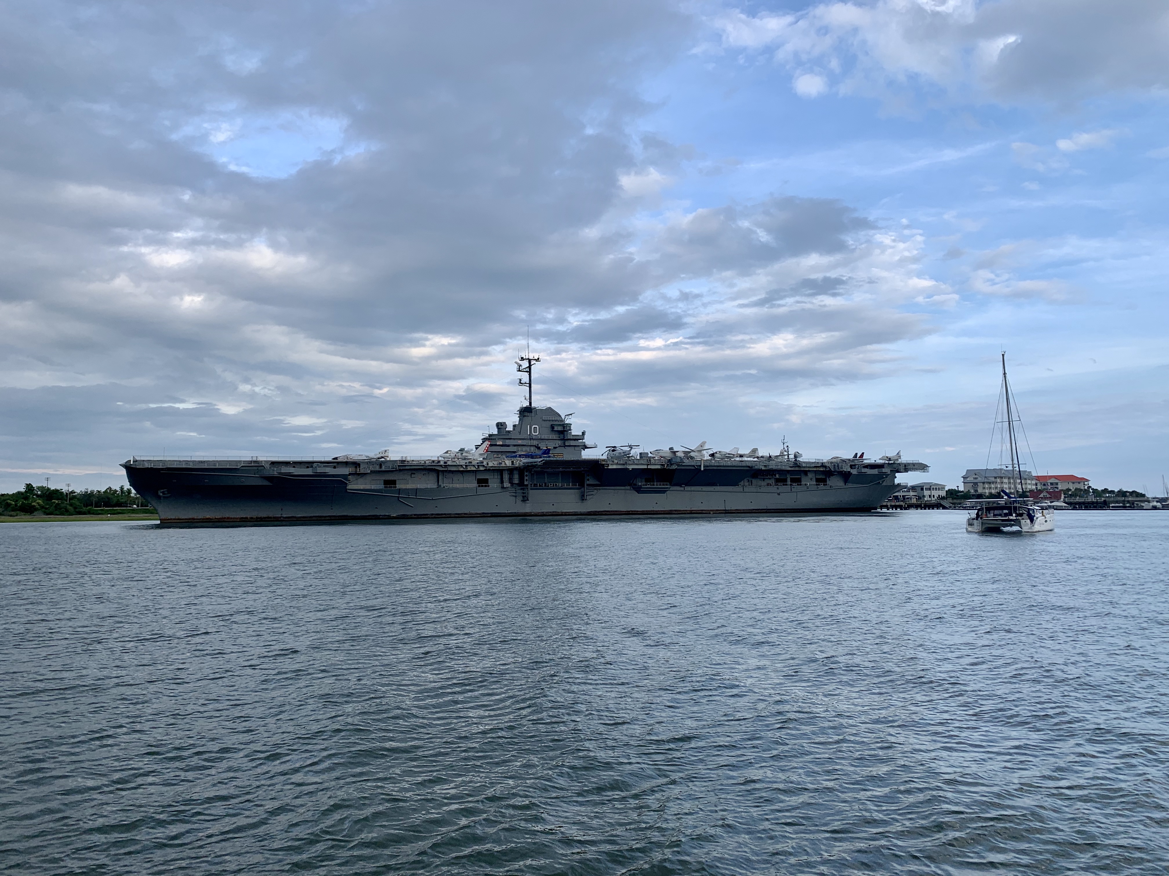
Once in Charleston, we initially anchored off the USS Yorktown, a historic WWII aircraft carrier. This was the view from Oyai after we dropped the hook.
We toured the aircraft carrier the following day and we all learned lots of details about WWII. This next photo is from the bridge of the Yorktown (you can see Oyai anchored in the background over Chuck’s left shoulder).

The Yorktown was the ship that recovered the Apollo 8 landing capsule and its astronauts in 1968, so there was an exhibit about that too.

There were many other cool things to see and learn about aboard the Yorktown.


This photo shows an F-18 on the deck of the Yorktown with Oyai and downtown Charleston in the background. The surrounding area was very flat, but Charleston turned out to be a charming city with lots of friendly people.

Horse-drawn Carriage Tours were popular in Charleston and the horses were beautiful. Again, Micah was in horse heaven.

We had a couple of really nice days before the storm hit, and we explored Charleston by foot, scooter and rollerblade. There were lots of colonial buildings from the 1700’s and 1800’s. We also went to a Slave Market Memorial Museum in Charleston which was heartbreaking, but very educational.

The day after the storm passed, we caught the eastern side of the low (now blowing from the south). We knew this weather window was also going to be brief so we planned on making it to Beaufort, North Carolina, 200 nautical miles to the north. On our 36 hour voyage, a small bird (likely blown out to sea by the high winds), took refuge on Oyai.
Beaufort turned out to be another winner, with lots of history and many things to do. Our anchorage was just off of the small downtown and the sunsets were awesome.

Opposite downtown Beaufort (just behind our boat) was an island with a small population of wild horses. Though to have been abandoned here in the 1600’s by the Spanish, this horse population has thrived.


There was an amazing Maritime Museum in Beaufort. Blackbeard scuttled his flagship the “Queen Anne’s Revenge” here in Beaufort and there were many artifacts from the wreckage at the museum. As part of homeschooling, the girls used the museum’s library to research and write about a topic of their choosing. Aria wrote about the fisheries around Beaufort and Micah did a project on “Queen Anne’s Revenge”.

Beaufort had a really good Saturday market, and there was a booth promoting local wildlife rescue. Aria & Micah were able to get up close and personal with an albino rattlesnake named “Blanco”.

Chuck had been with us, sailing and waiting for weather, for 2 weeks. He was a huge help, but had to get home to Vancouver. Once the weather started looking more promising to make it safely around Cape Hatteras (the most dangerous area on our path northwards), we called up Oyai’s next owners Noel and Sue. You see… way back in February, they had expressed serious interest in being the next owners of Oyai. So…we called them to see if we could get some help with the next leg of our journey to the Chesapeake Bay. Noel quickly obliged, and made it down to Beaufort in record time to help us get around Hatteras. Luckily, the weather was mostly calm and we motored into the Norfolk, Virginia area on June 6th. We will spend a few days here and report back about our activities in the southern Chesapeake soon!


No comments:
Post a Comment